
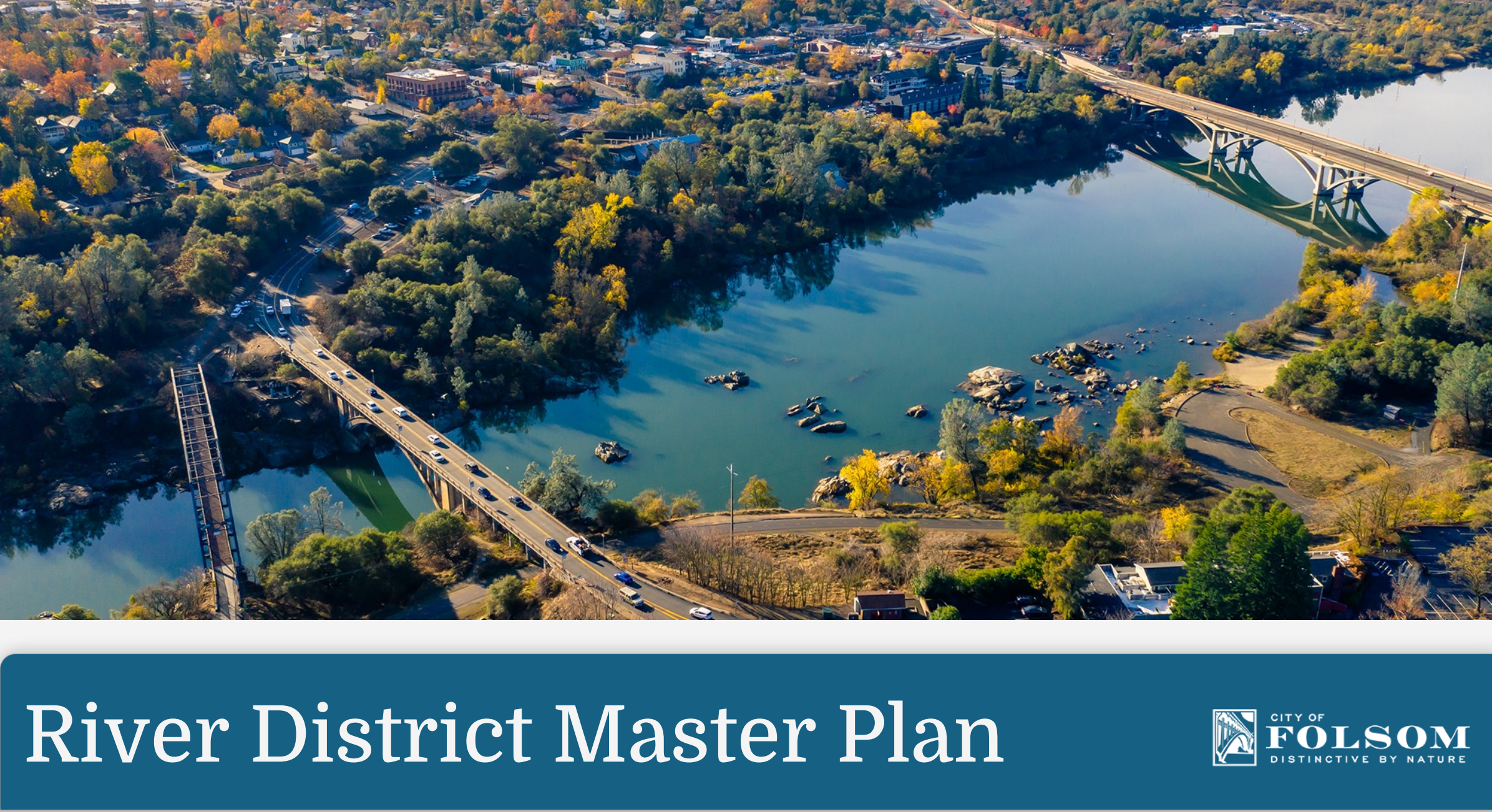
The Folsom City Council last week approved a lengthy river district “Vision Plan” to guide future development along the American River waterfront.
The vast Folsom river district planning area includes six miles of shoreline along the American River and Lake Natoma through the city. The district includes federal, state, city and private lands between the river and Folsom-Auburn Road and Greenback Lane on the north side, and Folsom Boulevard on the south side.
The California Department of Parks and Recreation manages more than 75 percent of the district, while the federal Bureau of Reclamation owns the majority. State Parks has, however, acquired key parcels to increase and enhance the Lake Natoma Rec area. City-owned and private parcels make up the rest of ownership along the shoreline, staff said.
The 2035 Folsom General Plan contains a specific goal and objectives for a river district plan, authorities said. Council members praised the effort last week.
“For 10 years now, I’ve been in the historic district,” said Councilmember Rosario Rodriguez. “When I look at this tonight, it’s exciting. It’s the opportunity and potential of what the historic district can be, better than it is today. I look at this as a huge economic driver for the city.”
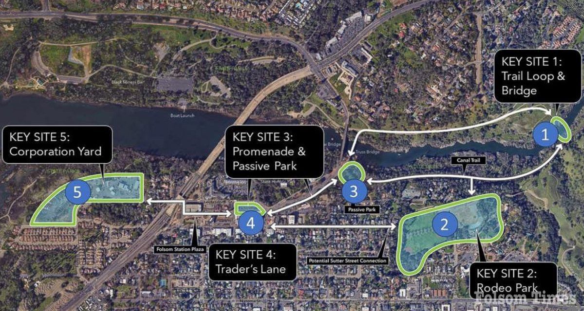
At the last September meeting, the committee added some 11th-hour language to the plan. One is to improve access to Willow Creek parking lot and amenities at Lake Natoma.
The committee also added a recommendation to coordinate with State Parks to improve boat launching at Black Miners Bar, including boat storage and emergency launching facilities.
The River District vision planning included robust community engagement, public meetings, print and digital information and notifications, online public comments and mapping.
The city council established the first River District Citizens Advisory Committee last year, approving $362,500 of American Recovery Plan Act funds for project management services of $62,500 and a consultant for $300,000. The committee was extended six months to finish the plan by the end of this year.
The River District Vision Plan does not propose specific projects, nor does it rezone any land. No specific project proposals are part of the vision plan.
“Key sites” have been prioritized for illustration, and concepts have been identified such as access improvements, trail connections, way-finding and environmental, historical and cultural resource interpretation opportunities.
Staff recommended the title be changed, because a master plan does not have a specific and consistent content requirement, nor are they identified as an enforceable planning document like a general plan, specific plan or zoning code.
The CAC strongly recommended the document be retitled as the “River District Vision Plan.” The CAC’s view is the name change also adjusts the expectations of the reader and more accurately describes the plan contents and purpose. The 147-page main document is available for public view at the city website.